Geographical Overview of Kenya
The Republic of Kenya is a fascinating country with rich geographical features as well as diverse sociocultural and physical settings. Remarkable landmarks and expansive landscapes shaped by nature provide a home to many Kenyan cultural communities and a range of languages that extend across the length and width of Kenya’s 592,586 square kilometres. Kenya has a unique combination of wildlife sanctuaries, with resorts and camps, a beautiful coastline with sophisticated accommodation, welded together by a hospitable and happy people.
Kenyan neighbours: –
Kenya is neighboured by Tanzania to the southeast, Uganda to the west, South Sudan and Ethiopia to the north, and Somalia to the east. The country extends from the low-altitude coastal belt of the Indian Ocean in the southeast and gradually the elevation rises to just above 1,000 m above sea level before flattening along the extended length of the Yatta Plateau. The monotony of the flat plains is intermittently broken by residual hills, namely the Taita and Kyullu Hills, which are masses of broken boulders and inselbergs of the Kibwezi–Makindu line. The Yatta Plateau is flanked by the rising Mbooni and Machakos Hills to the west, where the elevation gradually drops down to the Tana River before climbing rapidly to form the Central Highlands.
Central Highlands: –
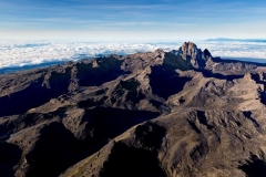
These reach an imposing 5,200 m above sea level to form the country’s most spectacular snow-capped national landmark, Mount Kenya. To the west, the Aberdare ranges rise to just over 4,000 m above sea level. These two landmarks form one of the most important water towers in the country. The Central Highlands, spreads like a giant mantle on both sides of the Aberdare Mountains, which stretch northwards more than 100 miles fromNairobi.This is an area of rich agricultural land and dense forest. The principal cash crops are coffee, tea, maize, horticultural produce like flowers and green beans, and pyrethrum (used in insecticides). This is an area of bracing air, farming activity and restful scenery.
The Kenyan highlands: –
The Kenyan highlands comprise one of the country’s breadbaskets owing to the highly reliable precipitation and fertile soils. Livestock is raised here and it is also where the most successful large- and small holder commercial farming is practised, with crops including tea, coffee, pyrethrum, wheat, and maize. The western highlands separate the Lake region from the rest of the country, and stretch from Kisii in the south to the tea plantation areas of Kericho, before continuing through to Kitale, Eldoret, and further north to elevations 4,300 m above sea level. This is where the impressive Mount Elgon rises up, the product of an extinct volcano. These highlands are also known for their high agricultural potential, making them the second of Kenya’s main breadbaskets.
The Great Rift Valley: –
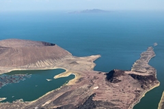
The Great Rift Valley (a massive fracture line in the earth’s surface which runs 5000km from Jordan in the north through Kenya to Mozambique in the south) is perhaps the most outstanding. The Great Rift Valley, which enters Kenya from its southwestern neighbour, Tanzania, continues on to its northern neighbour, Ethiopia, and divides the Kenyan highlands into east and west, creating another very striking feature of Kenya’s geography. Within the kenya rift valley lies a chain of eight lakes of various forms and composition, including the alkaline waters of an inland sea in the far north, Lake Turkana which has the popular name The Jade Sea because of its greenish colour. Extinct volcanoes stud the Rift Valley floor interspersed with the lakes.
The Lake region: –
In addition to Lake Victoria, Kenya is well endowed with small and large lakes, which dot the floor of the Rift Valley from Lake Amboseli in the south to Lake Turkana in the north. Lake Turkana, the “jade sea”, crosses into Ethiopia at its northern end and is the world’s largest desert lake. Lake Victoria, on the other hand, is the world’s second-largest freshwater lake, and is shared by Kenya, Uganda, and Tanzania. The lake basin is dominated by the Kano plains, which are suitable for farming through irrigation.
The Vast Arid and Semi-Arid Deserts of Kenya: –
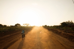
The vast arid and semi-arid deserts of Kenya’s northern regions which occupy around 200,000 sq.km. of the nation’s total landmass. Receiving only minimal rainfall, these lands are home to hardy nomads who number fewer than one fifth of the total population of Kenya. The awesome ruggedness of this terrain of withered thorn, scrub, laval rock and sand is punctuated by occasional forest-crowned mountain peaks, such as Marsabit, Mount Nyiru, Mount Kulal and The Nodot mountains.
The North and North-Eastern parts of Kenya: –
The northern and North-Eastern parts of Kenya are dominated by arid plains and several isolated mountains, most notably the Mathew and Ndoto ranges, Mount Marsabit and its beautiful Lake Paradise. The Songot Mountains, Murua Ngithigerr Laima, Lokwonamoru, and Lorionestom are found in the central, northern, and North-Western corners of Turkana. These isolated hills and mountains enjoy higher levels of precipitation, and thereby become crucial areas for resource concentration. Consequently, they represent convergence zones for both humans and livestock, especially those in search of water and pasture. Furthermore, numerous seasonal rivers and streams, which are important for distributing water to the much drier areas in the lowlands, are fed by sources in these hills and mountains, especially during rainy seasons.
The southern Rangelands/ The Rolling Grasslands: –
The southern rangelands border Tanzania. They stretch from the Lolgorien Hills through the Nguruman Escarpment, the Maasai Mara, and the Namanga Hills to end in the southeastern corner of Kajiado, where they are bounded by the Kyullu Hills to the east and the northeastern slopes of Mount Kilimanjaro to the south. The isolated hills of Lolgorien, the Nguruman Escarpment, and Namanga are also important grazing and watering areas during dry seasons.
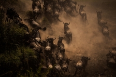
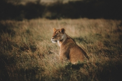
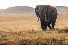
The Maasai Mara is considered one the most beautiful game parks in the world. The southern rangelands are rich in both livestock and wildlife resources, and are famous for the Maasai Mara game reserve, which forms one part of the monumental wildebeest migration along with the Serengeti National Park in Tanzania.
The Savanah Land: –A large tract of savannah housing three major game parks, Tsavo East and Tsavo West and Amboseli.
Kenya’s coastal Region: –
The coast area, a tract of nearly 300 miles of idyllic coastline stretching inoand between 10 and 20 miles. It has long stretches of white sandy beaches protected by a coral offshore reef, with clear aquamarine lagoons fringed by waving palm trees. Home to nine tribes known as Mijikenda, and the oldest settlement in Kenya, is Mombasa, the major seaport of East Africa.
Kenya’s coastal area is its major tourist attraction due to its beautiful and extensive beaches, first class tourist hotels, marine parks, and good weather that prevails throughout the year. The region has a lot to offer including its rich and largely intact culture and landmarks such as the Mombasa deep water Kilindini port, the national oil refinery, and the famous Fort Jesus.
Further north, the coast has even more attractions like the Malindi wonders, which include one of Kenya’s great unknown treasures, the thick canopy of the only surviving indigenous Arabuko Sokoke forest. This is also where one finds the Vasco Da Gama Pillar, which is over 500 years old, the Watamu and Malindi marine parks that open onto idyllic sandy beaches, and Hell’s Kitchen a few kilometres to the north of Malindi.
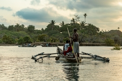
Further north, Lamu Island is home to one of the oldest and best-preserved Swahili settlements in East Africa. The town is almost devoid of motorized transport, and is traced by just alley ways and footpaths, making it no surprise that it has been listed as a World Cultural Heritage Site.
Hub of Africa: –
Kenya’s advantageous geographical location makes it the gateway to East Africa and a global travel hub. It is a crossroads for trade and communication, serving eastern and central Africa as well as the Horn of Africa. The capital city Nairobi is the regional commercial hub, while Mombasa is the largest port and serves the entire East African hinterland. All local and foreign trade and travel policies and legislation should therefore strive to facilitate the best possible conditions for reaping and preserving the potential provided by this rich geography
